


High-res images from a space mission involving Dr Stephen Lowry has revealed the multifaceted world of a comet's surface.
On 6 August, after a 10 year and 6.4 billion kilometre journey, the Rosetta spacecraft entered 67P/Churyumov-Gerasimenko’s orbit and raised expectations of what has turned out to be an exciting and unique opportunity to study a comet close up.
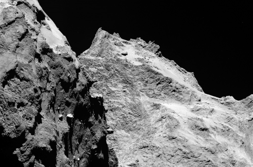
Scientists have now analysed images of the comet’s surface taken by OSIRIS, Rosetta’s scientific imaging system, and allocated several distinct regions, each of which is defined by special morphological characteristics. These include areas dominated by cliffs, depressions, craters, boulders or even parallel grooves.
Such an analysis provides the basis for a detailed scientific description of 67P’s surface and will offer valuable insights as Rosetta’s Lander Team and the Rosetta orbiter scientists gather in Toulouse on 13 and 14 September to determine a primary and backup landing site from the earlier pre-selection of five candidates.
Dr Lowry, who is part of the science team for the OSIRIS instrument, explained: ‘Each new image from OSIRIS is a unique close-up glimpse of the surface of a comet in unprecedented detail, which we can use to help us to understand how comets form. Part of that process is to map the surface and define all its distinctive regions. There is still plenty of work to do though as the spacecraft continues to escort the comet on its long journey towards the Sun, a journey which grows more exciting each day.’
Rosetta is a European Space Agency (ESA) mission with contributions from its member states and NASA. Its progress can be tracked via the ESA’s Rosetta Blog.
Dr Lowry is a member of the University’s Centre for Astrophysics and Planetary Sciences.